Efficiently manage your KML/KMZ/GPX files with MAPinr, a comprehensive GIS tool that also offers measuring capabilities, GPS logging, support for Web Map Service (WMS), and offline maps. At MAPinr, we understand the rapid evolution of Android versions poses challenges for non-profit projects. Despite these hurdles, we're committed to sustaining this project and delivering a secure, privacy-focused, and budget-friendly app.
We're aware that Google requires a minimum Android version that not all devices can support. To address this, we provide downloads for versions below Android 14 on our website, which are no longer available on the Play Store.
Are you looking to manage your personal points of interest or visualize your photos on a map? MAPinr is your go-to ad-free Android app for managing KML/KMZ files and viewing GPX files across various map types. Whether you're a professional or an enthusiast in hiking, cycling, running, skiing, and more, MAPinr is designed to meet your needs.
We value your feedback and welcome your ideas on enhancing MAPinr. Please send your thoughts and suggestions to [email protected]. We understand that encountering software bugs can be frustrating, and we ask for your patience as we work with limited resources to improve the app.
MAPinr offers the following key features:
- Ad-free experience
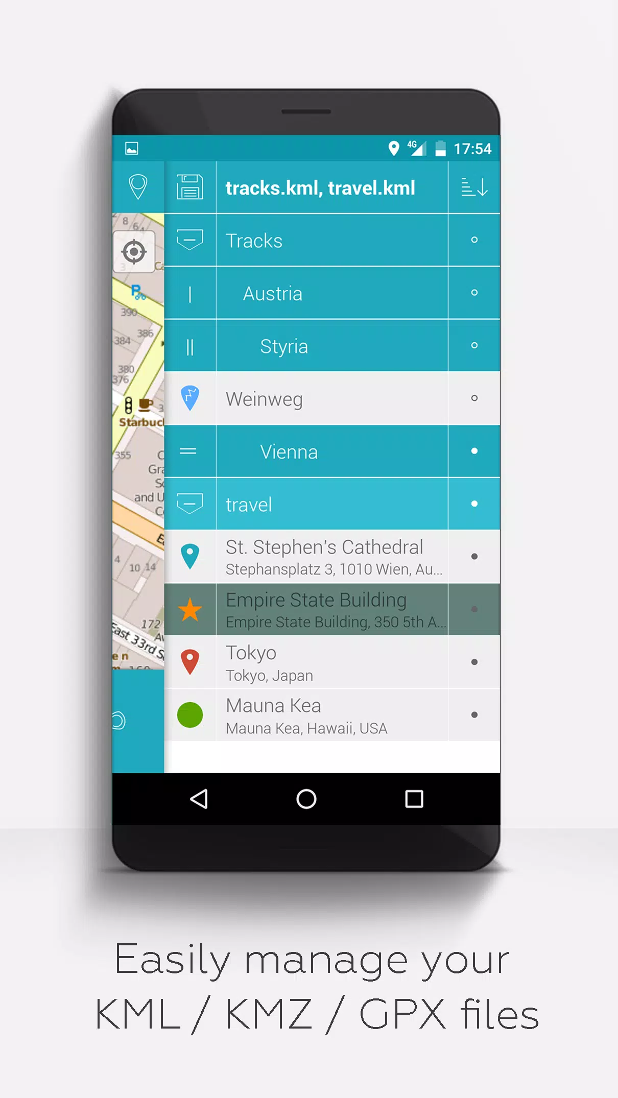
- Hierarchical folder structure for managing KML/KMZ/GPX files
- Create, load, edit, save, import, export, and share KML/KMZ files
- Create, load, edit, save, import, export, and share waypoints, lines/tracks, and polygons
- Add pictures to waypoints to create photomaps
- Display waypoints, lines/tracks, and polygons on various maps including Maps, Satellite, Hybrid, OpenStreetMap, Opentopomap, and Opencyclemap
- Share waypoint coordinates
- Customize the color of waypoints, lines/tracks, and polygons
- Open exported KML/KMZ files in other apps
- Search by name, address, and coordinates
- Location sharing to keep friends informed of your whereabouts
- Simultaneously display multiple KML/KMZ/GPX files
- Merge KML/KMZ files
- Cloud integration
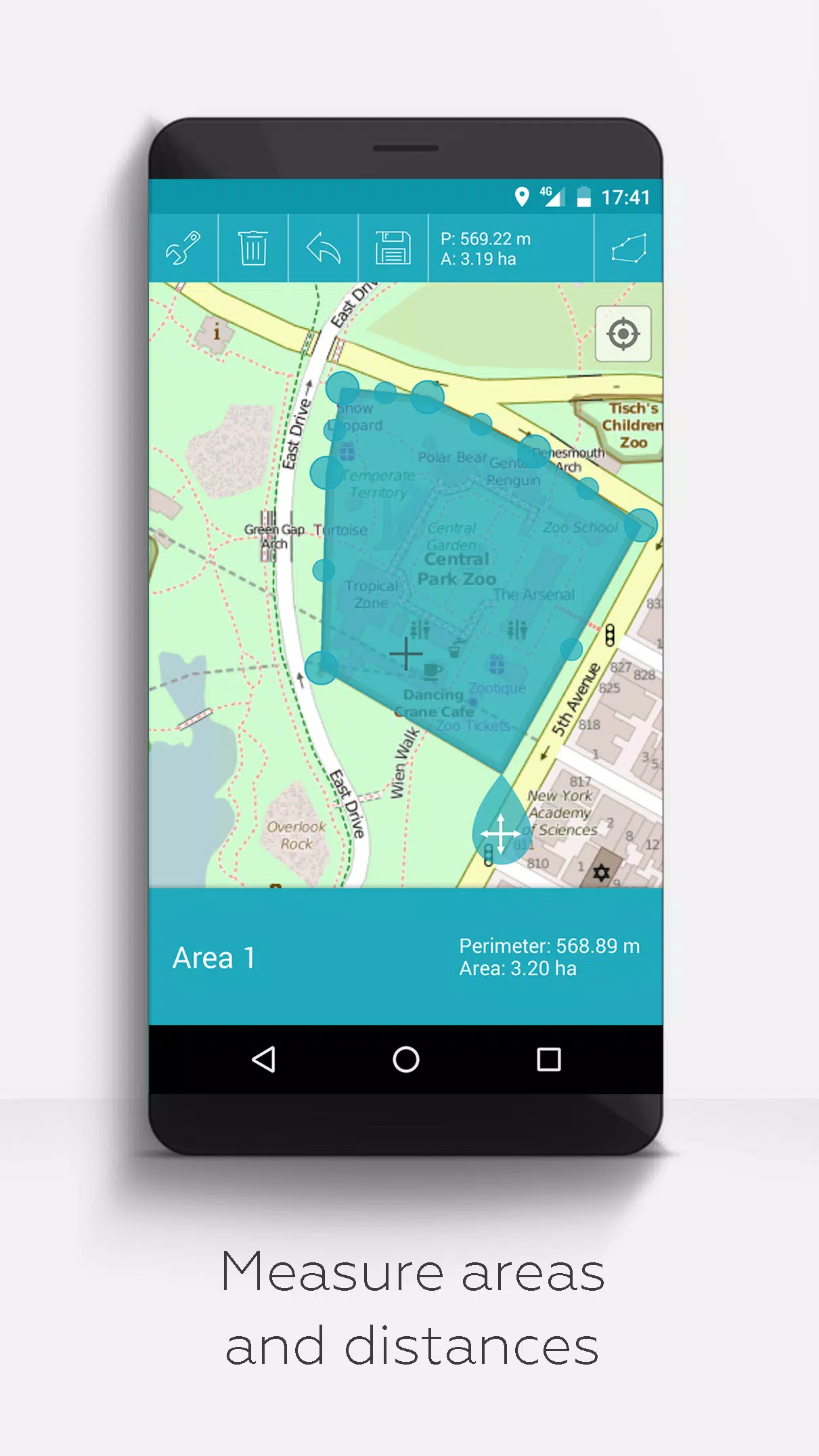
- Measure distances and areas on maps
- Multilingual support (currently available in English, Spanish, Lithuanian, Polish)
Unlock extended features for free with donations or a LinkedIn like, which can be activated in the app settings:
- Download free offline maps from OpenStreetMap
- View GPX files
- Use Web Map Service (WMS) to display various map data, such as from www.data.gov
- Create custom metadata
- Upload and use custom icons
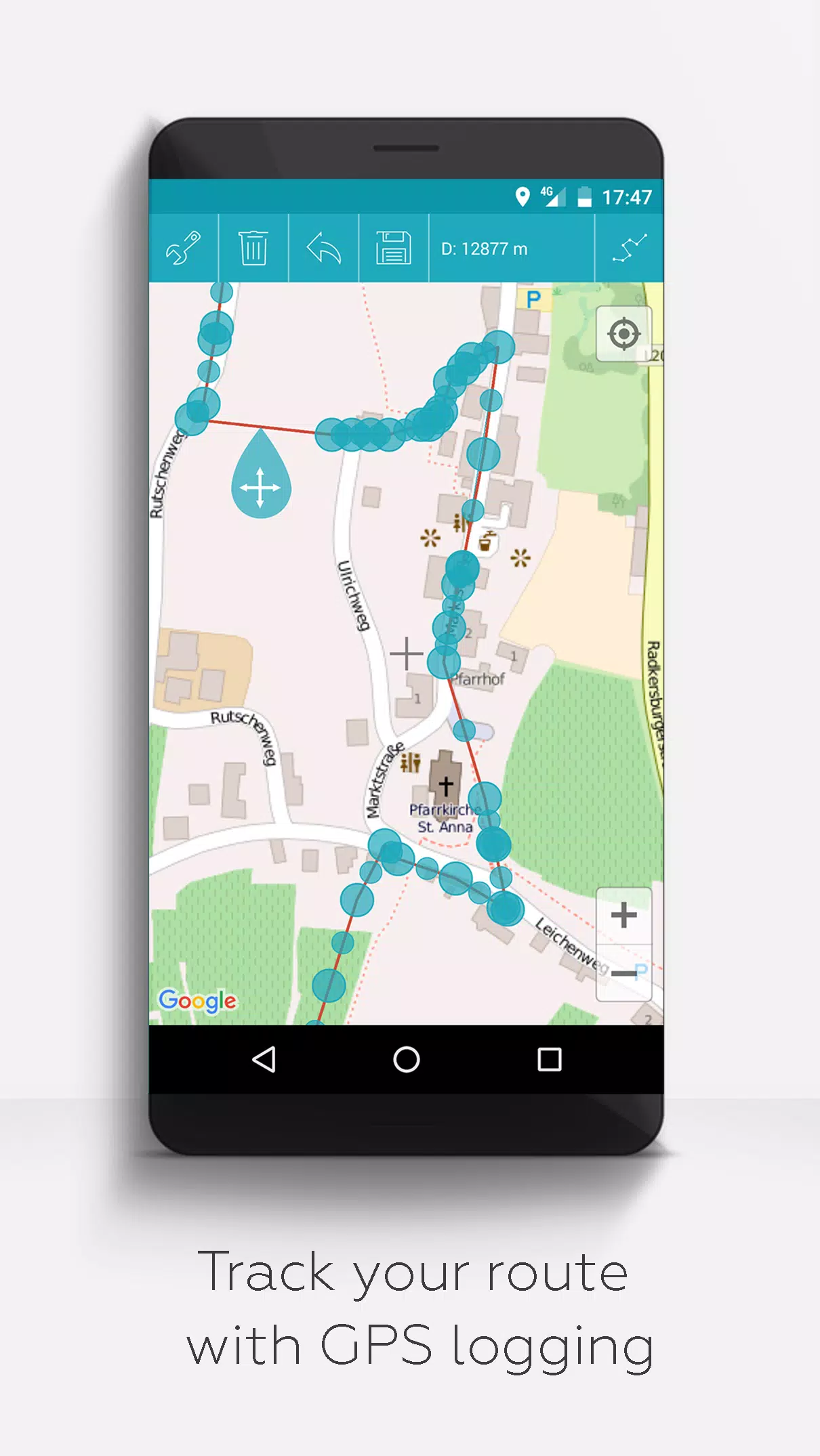
- Record GPS tracks
Unlike similar apps, MAPinr respects your privacy and does not collect or sell your personal data. Donations are voluntary contributions that support our non-profit efforts.
Tags : Travel & Local