Zoom Earth provides an interactive global weather map and a real-time hurricane tracker, offering a comprehensive suite of features for tracking hurricanes, typhoons, and tropical cyclones. Here’s a detailed look at how Zoom Earth can help you stay informed about these severe weather events:
Key Features for Hurricane, Typhoon, and Tropical Cyclone Tracking:
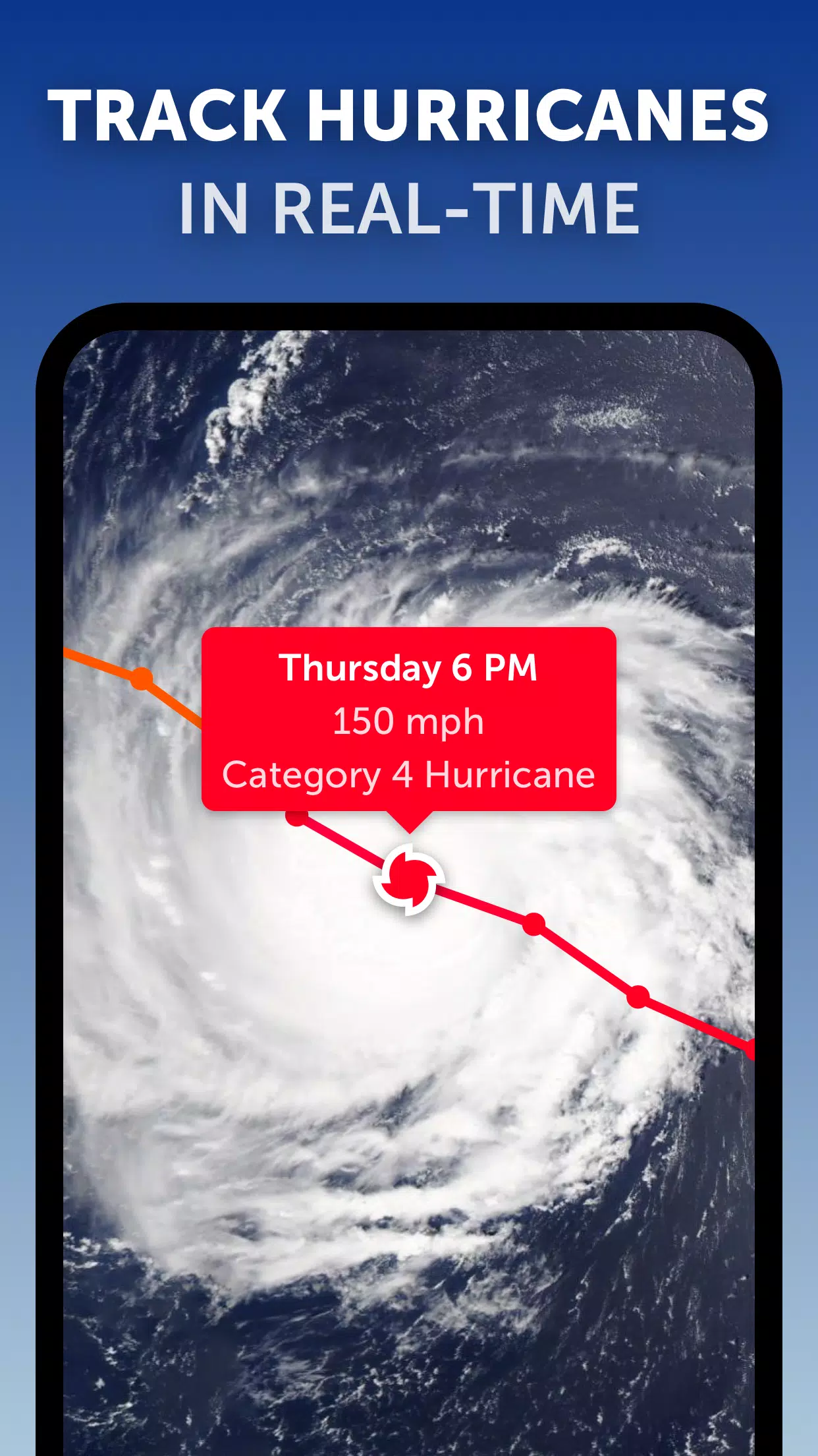
Satellite Imagery: Zoom Earth utilizes near real-time satellite imagery from NOAA GOES, JMA Himawari, EUMETSAT Meteosat, and NASA polar-orbiting satellites Aqua and Terra. This high-quality imagery allows users to monitor the development and movement of tropical storms across the globe.
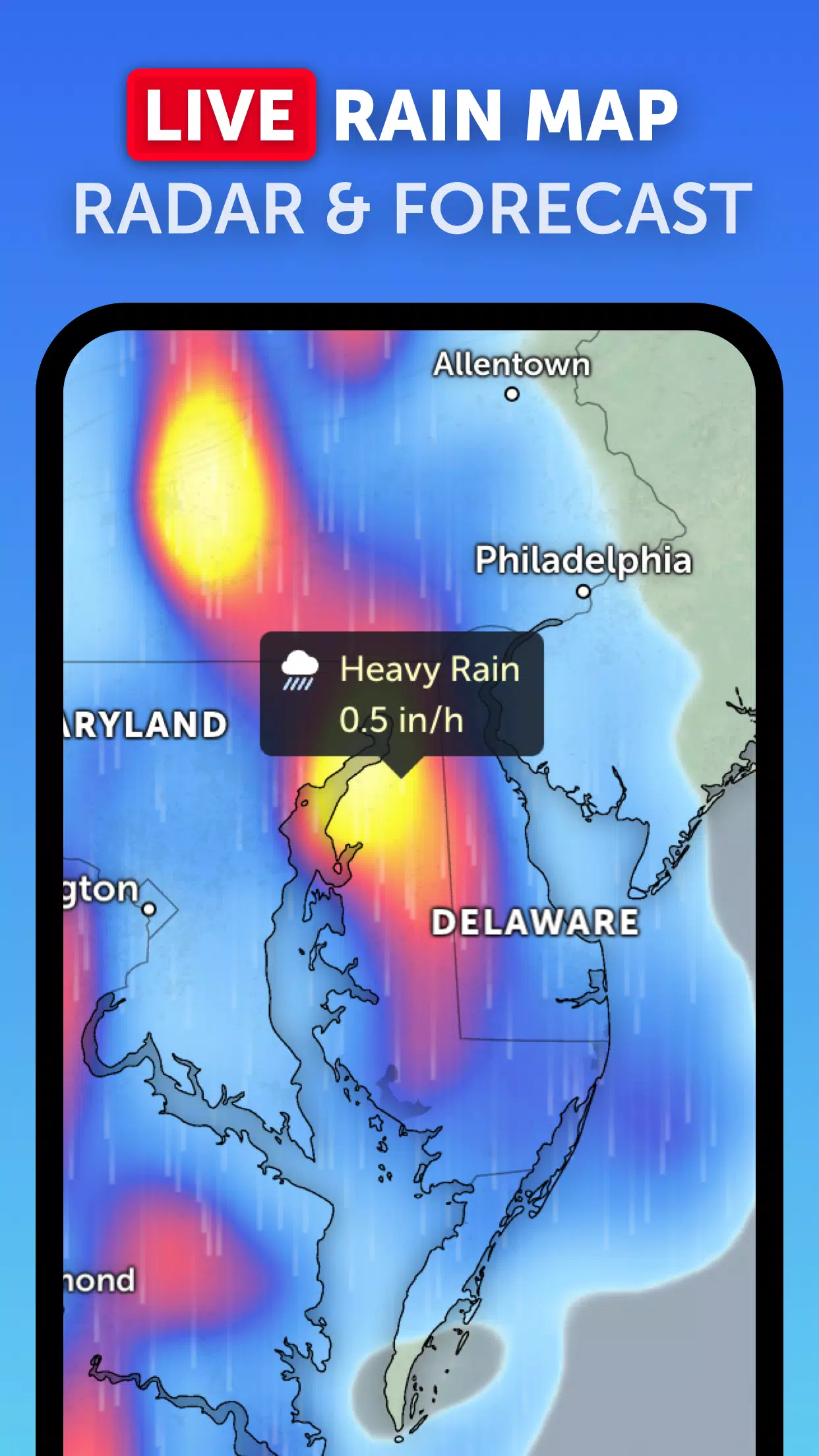
Rain Radar: The platform features a real-time weather radar map that displays rain and snow, enabling users to see the immediate effects of hurricanes and typhoons as they approach land.
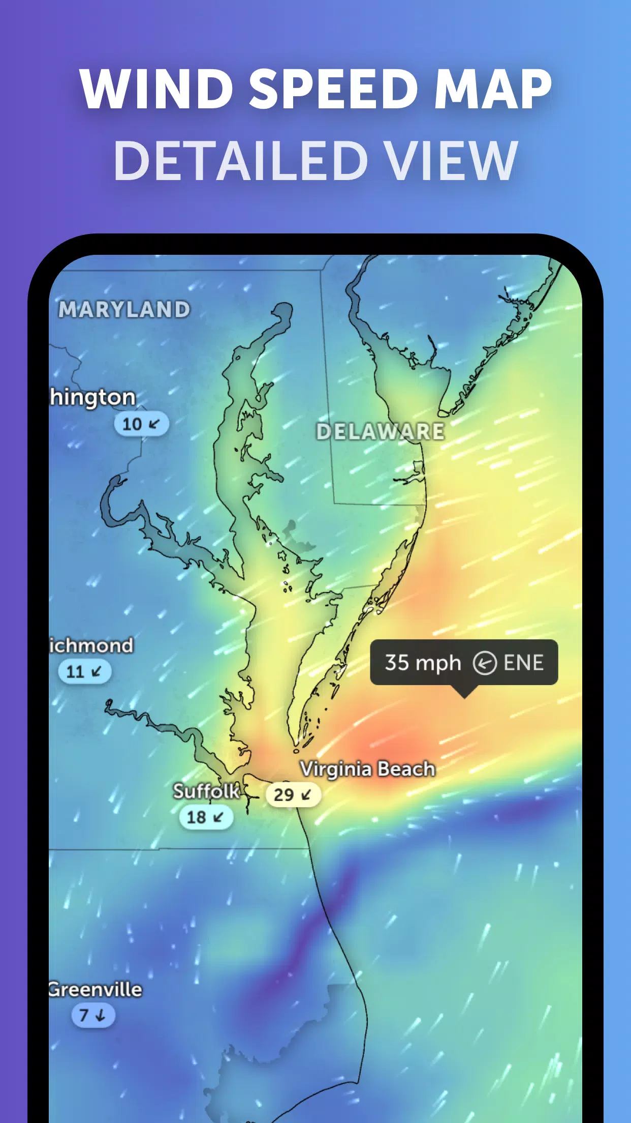
Weather Forecast Maps: These interactive visualizations include forecasts for precipitation, wind speed and gusts, temperature, "feels like" temperature, relative humidity, dew point, and atmospheric pressure. These maps are crucial for predicting the path and intensity of tropical cyclones.
Hurricane Tracking: Zoom Earth's best-in-class tropical tracking system provides real-time updates on hurricanes from their development stage to category 5. The system uses the latest data from the National Hurricane Center (NHC), Joint Typhoon Warning Center (JTWC), Naval Research Laboratory (NRL), and the International Best Track Archive for Climate Stewardship (IBTrACS).
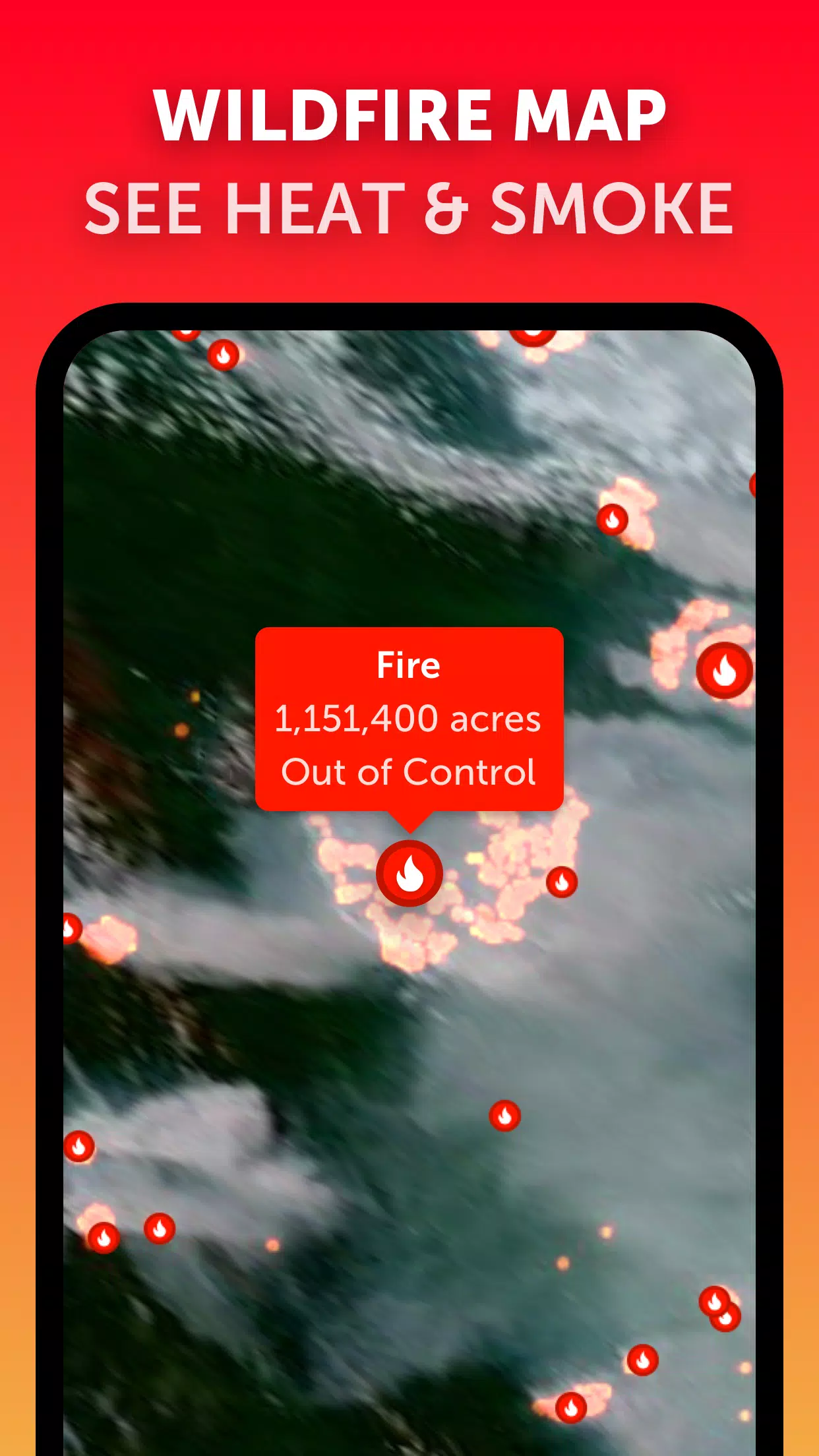
Wildfire Tracking: Although primarily focused on fires, the active fires and heat spots overlay can also be useful for understanding the broader impact of tropical cyclones, especially when they cause fires upon landfall.
Customization: Users can tailor their experience by adjusting settings such as temperature units, wind units, time zone, and animation styles, ensuring the information is presented in the most useful format.
What's New in Version 3.1:
- Reduced Clutter: Enhancements have been made to reduce visual clutter when multiple tropical systems are being tracked simultaneously.
- Separate Alerts: New separate alert systems for Atlantic and Eastern Pacific tropical systems provide clearer, more region-specific information.
- Map Label Improvements: Updates to map labels make it easier to identify and track hurricanes, typhoons, and tropical cyclones.
By using Zoom Earth, you can stay updated with the latest developments in real-time, ensuring you're always ahead of the storm. Whether you're tracking a hurricane in the Atlantic or a typhoon in the Pacific, Zoom Earth's comprehensive features and up-to-date information make it an invaluable resource for monitoring these powerful natural phenomena.
Tags : Weather