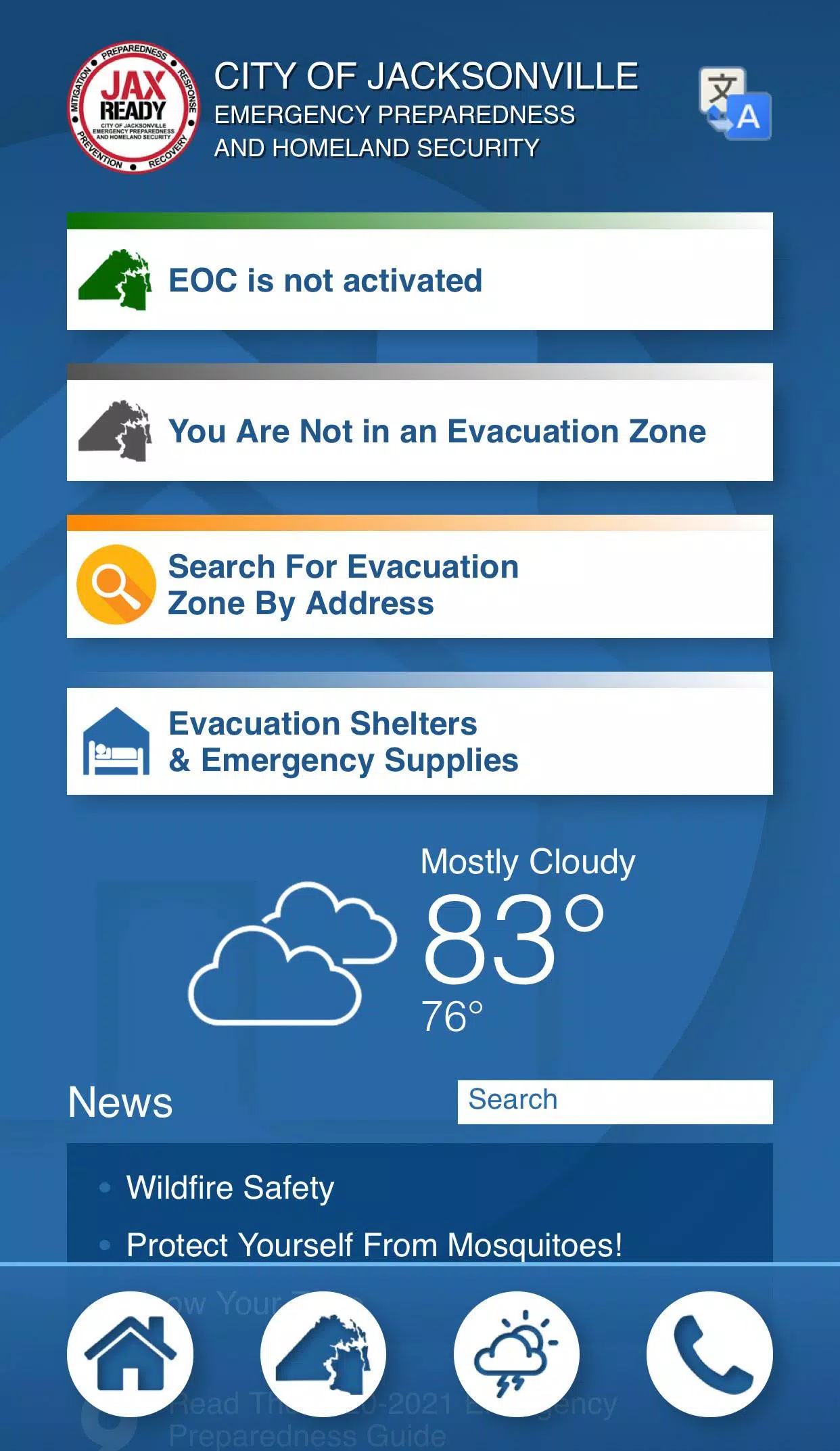
Are you ready? JaxReady, provided by the Emergency Preparedness Division and Information Technologies Division of the City of Jacksonville, Florida, is your essential tool for preparing for natural disasters. This platform helps you stay informed and plan effectively for emergencies, including evacuation scenarios.
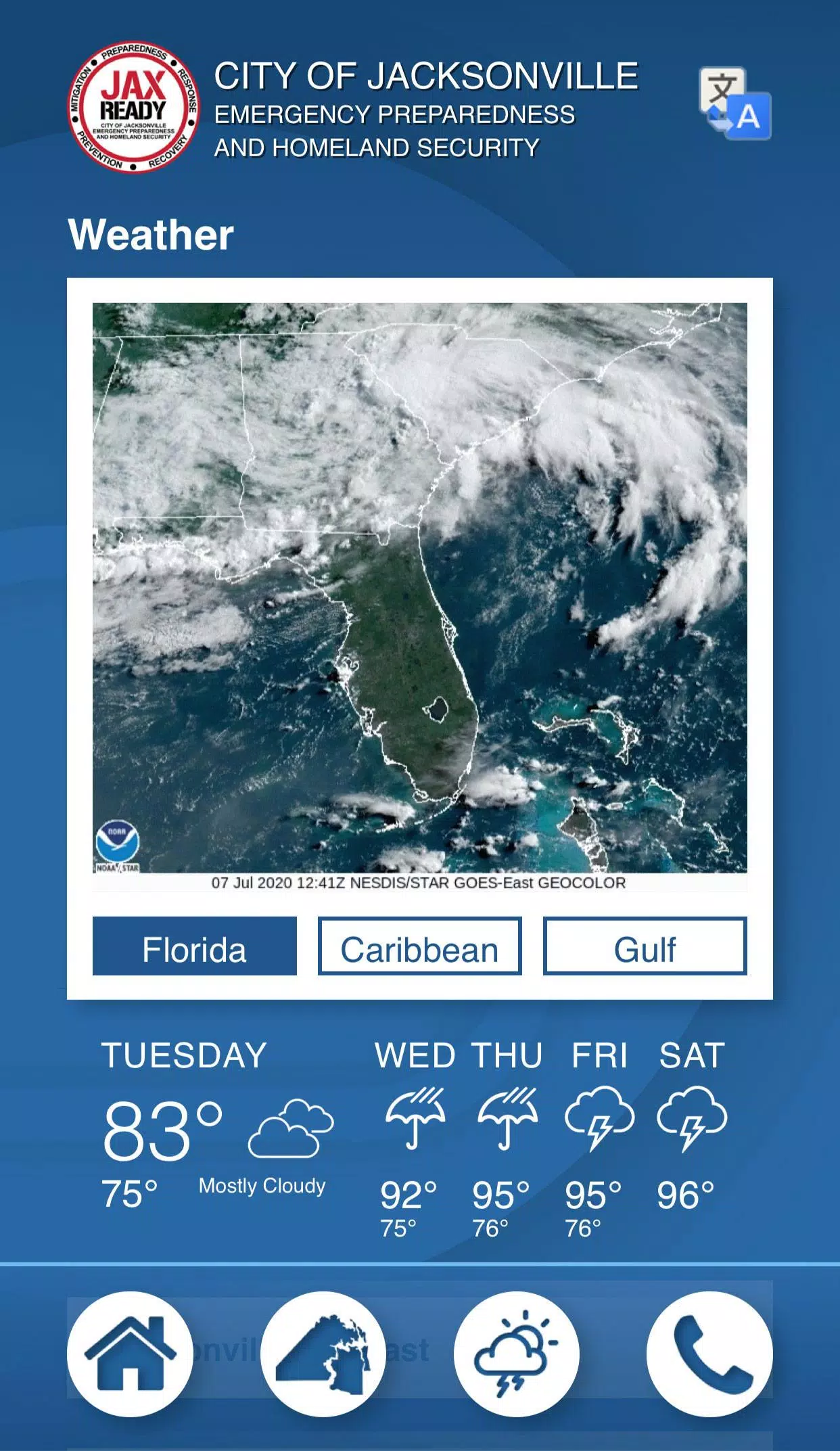
JaxReady offers comprehensive access to real-time information, including current threat levels, detailed weather reports, and the latest wildfire updates. It also features up-to-the-minute news feeds dedicated to emergency preparedness and evacuation procedures.
Features:
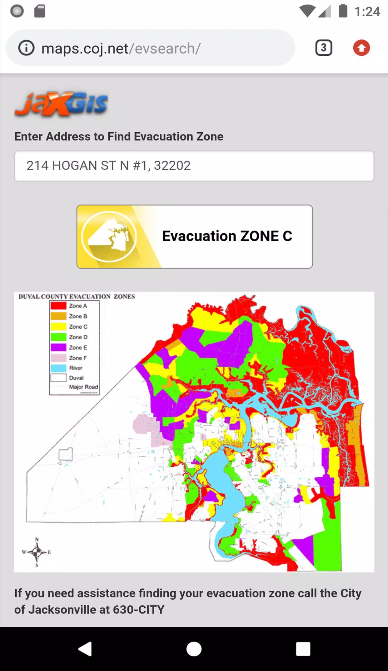
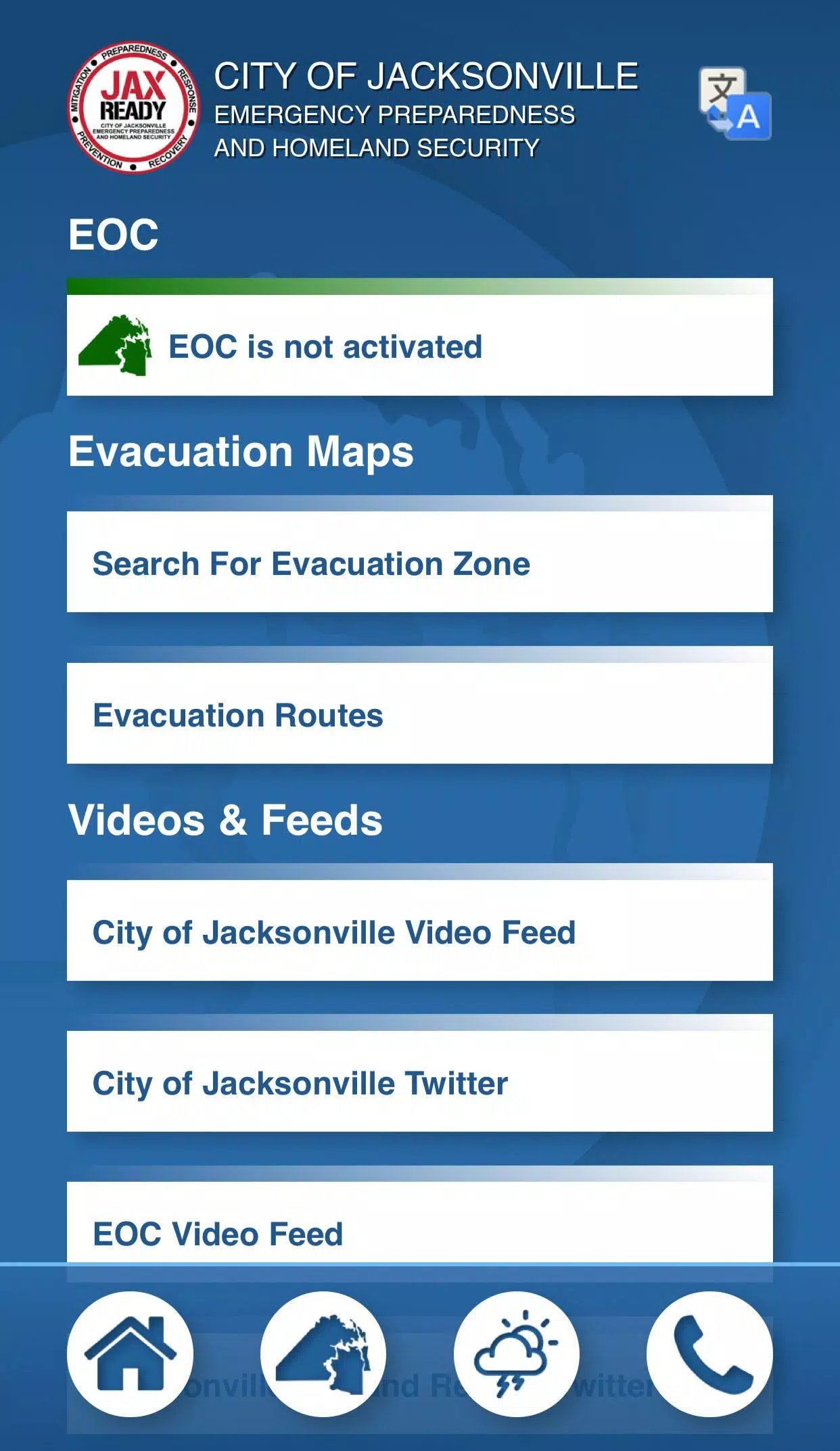
GPS Functionality: Easily locate your designated Evacuation Zone using GPS technology.
Real-Time Alerts: Receive updates on the current Emergency Operations Center (EOC) Activation Level, Weather Threat Level, and Fire Danger Index, all tailored to your specific geolocation.
Special Needs Registration: Access links to register for special needs assistance, ensuring those with medical requirements are supported during evacuations.
News and Updates: Stay informed with the latest weather and fire news.
Interactive Maps: View detailed maps of weather patterns, wildfire spread, and drought indices to better understand potential risks in your area.
With JaxReady, you can enhance your preparedness and ensure you're ready to respond effectively to any natural disaster that may affect Jacksonville, FL.
Tags : Weather